Picture
More information on Itaparica Island in Salvador

Description: Itaparica Island in Salvador
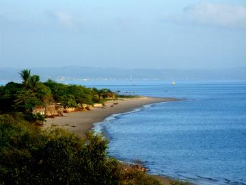
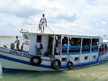
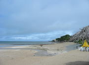
It is the largest maritime island in Brazil with 239 km ² offering beautiful landscapes formed by tropical vegetation, surrounded by coral beaches, historic monuments and an excellent urban infrastructure. It is located 31.5 nautical miles (17 km) from Salvador and its main access is through the Terminal Marítimo de São Joaquim (Ferry Boat or catamaran) with about 40 minutes away and landing in Terminal maritime Good Dispatch there, the rest of the route is by car. Access also take place via state roads around the island or can be done by schooners (private boats) rides that are sought after and have many destinations as the islands of the Bay.
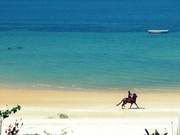
On the side of the island facing the ocean, there is a formation of a Great Barrier Reef, which gave rise to its name: the Tupi Itaparica "fence made of stones." This barrier, with a length of 15 km, makes this side are the beaches of calm with few waves and formation of pools conducive to bathing and diving.
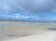
Since the western part of the island facing the mainland, is a region of swamps, small fishing villages and private islands.
The southwestern part, where is situated the beach of Cache-nail in front of Ponta do Garcia, is bounded by Canal de Itaparica, and is the boundary between the island and the mainland, home to large areas of mangrove in good condition. This region is known as "Bahia Pantanal" because it is an ecological sanctuary, cut by rivers, canals and wetlands, and supports a large fauna, especially the presence of armadillos, paca, wolves and anteaters. For a tour of the region can be charter boats.
The island of Itaparica Salvador was incorporated on August 8, 1833 and a city on July 30, 1962, after having been spun through two counties: Itaparica and Vera Cruz.
Itaparica is formed by the towns of Porto Santo, Manguinhos, Amoreiras and Ponta de Areia (highly visited beach).
In the village of Itaparica, you can visit some historic buildings such as the Solar da Praça da Piedade, built in the 18th century, the church of San Lorenzo, built in 1610 and the Fortress of San Lorenzo, built in 1711, and the Fountain Park Bica with a source of mineral water as one of the best in the country.
Vera cross is formed by the towns of the Rock, Bar Gil, crown, Barra do Pote, Conception, Barra Grande, Tairu, Aratuba, Berlinque, Cache-and Prego Great Sea to the municipal headquarters.
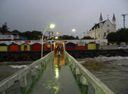
The city of Vera Cruz has a great number of hotels, inns, bars and restaurants. There are also villages of fishermen and vacationers spread all over the edge. The city also offers perfect conditions for ecotourism and adventure tourism, especially nautical sports and air (parachute).
More Photos of Picture